
About
Converting abandoned railroad beds, streetcar beds, and canal towpaths into trails for public recreation, health, and enjoyment has become an on-going nationwide movement for the past twenty years or more.
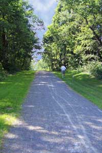
Local visionaries have come together to develop such a trail for the Bellwood-Antis area. It is currently is the early stages of developement, so much help is needed.
Through this website, we hope to keep you informed as to the progress of this development, and what you can do to help.
We sincerely hope you will catch the vision, and do whatever you can to help provide this facility for the community, visitors to our area, and for future generations.
Contact
Antis Township Board Of Supervisors
909 North Second Street
Bellwood, PA 16617
Email: dbrown@antistownship.org
Directions
Take Bellwood Exit 41 off of I-99. Follow PA-865 for 2.7 miles to Igou Road which will be on your right. Go .1 mile on Igou Road. Turn left into Bells Gap trailhead parking lot. Trailhead lot includes picnic table and picnic pavilion and a portable toilet.
History
The Bells Gap Railroad was introduced as a narrow gauge spur line in the 1850’s with the intention of connecting the Pennsylvania Railroad Mainline to the people and resources in the northern portions of Pennsylvania. It would move people and goods northwest and would help the coal and lumber industry to the west move their goods to the cities along the Mainline and beyond.
The spur line connected to the Mainline in the center of Bellwood, near where the Bellwood-Antis Community Park is now located. Eventually, the spur would be converted to a standard gauge line in 1872, allowing easy exchange of cars and the goods they carried. Though the slope was steep and the ascent of the Allegheny Front was slow and difficult, the line was an important transportation artery for both goods and people until the current Route 865 was improved in the 1930's.
Like most rail lines of the time, the builder and original owners, the Bells Gap Railroad Company, kept the incline below four percent. This could only be accomplished by wrapping around some of the stream valleys on the escarpment to lengthen the horizontal distance of the climb. The most noteworthy of these is above the Bellwood Reservoir on Shaw Run. The curve near the confluence of Bells Gap and Shaw Run produces an exceptional view of the valley that trail users are now be able to enjoy. At four percent, the slope of the right-of-way provides for a gradual ascent well suited not just for the railroads of the 19th century, but for cyclists, hikers, cross-country skiers and horseback riders of the 21st. After leaving Bellwood Borough, the trail goes westward toward Roots Crossing. It parallels Route 865 toward the scenic Bellwood Reservoir on land now owned by the Bellwood-Antis Community Trust. The Altoona City Water Authority has granted a right-of way through their watershed property above the reservoir. The trail then crosses through Pennsylvania State Game Lands, terminating in the village of Lloydsville at the top of Blandburg Mountain.
The trail meanders gently through the bends of the Allegheny Front, across mountain creeks and offers several stunning views of the valley. Take a break at one of the many vistas to gaze out over the Tuckahoe Valley, enjoying the majesty of the rolling mountains and the tranquil blue waters of the reservoir. A few forgotten railroad spikes can still be found along the trail, rusted and corroded, a reminder of the industry that catapulted the dusty settlements of Bellwood and Blandburg into prosperity during the heyday of the railroad.
The Logan Valley Streetcar Trail
The Logan Valley Streetcar Trail is a proposed connecting trail to the Bells Gap Trail. It would follow the path of the streetcar and trolley line that connected Hollidaysburg, Altoona, Bellwood and Tyrone.
The Bellwood-Tyrone portion ceased operation in 1936, but much of the right-of-way remained in the control of the electric utility that supplied power to the trolleys. This meant that much of the line remained unaltered except for the inevitable growth of trees and underbrush. The original ballast stone can still be found at the base of the trail and several bridge abutments are still visible where the trolley crossed the Little Juniata and its tributaries.
Phase one of this trail will start in the village of Pinecroft and connect with the Bells Gap Trail at the pedestrian bridge near the community park. The long term goal is to restore the trolley line as completely as possible, perhaps someday reconnecting Hollidaysburg, Altoona and Tyrone.
Connecting Our Communities, the Past and Present
This trail system will someday link not only northern and central Blair County and Bellwood and Blandburg, but should forge a connection between past and present. It connects the men and women whose livelihoods once depended on the railroad. It recalls the days when it was the only dependable mode of transportation to connect these communities. It is our hope that future generations will follow its path for recreation, exercise, a greater appreciation of our natural beauty and resources, and a new understanding of the fascinating history behind Bellwood-Antis and Blair County.
Links
Bells Gap Offers Hikers Area History of Railroad
|
|